|

Our most recent visit in the fall of 2015 was not blessed by the fates. Back in August we had made a two-week reservation starting the Tuesday of Thanksgiving week. But the park closed the day of our planned arrival due to strong southeast winds that were expected to flood the low-lying road. We had to scramble to come up with an alternative plan. We learned a bit too late that when the park is evacuated like that, all reservations are cancelled and it becomes a first-come/first-served free-for-all when it reopens. When the reservation system came back up, we were able to grab our site, A-35 for a week after our original time-frame. But even that didn't pan out too well. Another projected spell of winds forced another evacuation after only 4 days.
|
|
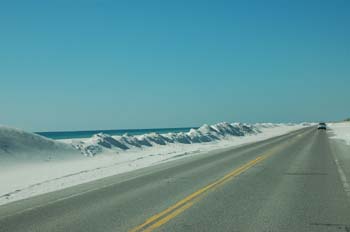
Over Thanksgiving weekend in 2015, the park was hit by strong southeasterly winds that at times of high tide brought water and sand up over the road. After the road is cleared, the piles of sand plowed off the road look like snowbanks.
|
|

In March of 2013 we had to play the reservation game and reserve a site, E-38.
|
|
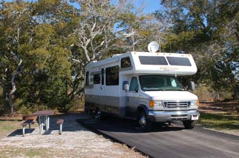
Back in Jan 2011, at the time of our first visit here, during the winter months, all sites were first-come, first served. Beginning on 1 March reservations could be made through the government recreation web site. There were lots of empty sites; we chose A-35 because of its sunny orientation.
|
|
As you enter Loop A, which is a separate campground, you'll see sites 1-8 straight ahead.
|
|
Sites A12-A17.
|
|
Sites A17-A25.
|
|
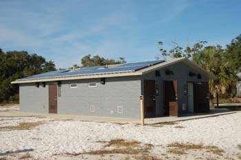
Since our last visit new bathhouses have been built in both campground loops. This is the one in Loop A. It has four individual shower rooms at one end and a laundry room at the other, but no machines have been installed yet. The larger campground of Loops B-E has two of the these new buildings.
|
|

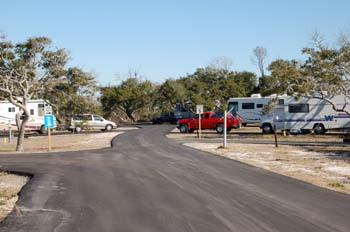
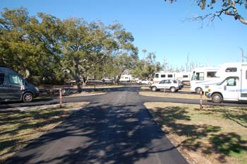
A much larger campground with four loops is located a few hundred yards down the beyond Loop A. It is much more open than Loop A, apparently from tree damage from Hurricanes Ivan and Dennis. This view is looking at sites C-28 to C-44.
|
|

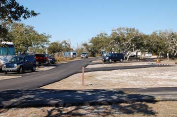
There are a few shady sites left, however. Sites D-2 - D-4 are on the left, with sites E-2 and E-3 on the right.
|
|

Loops C and D are obviously intended for tent campers, although they do have hookups. The paved areas are only large enough for a car. Here we're looking down from Site D-28 on the left.
|
|

B-9 is a unique site with raised tent platform and table/fire-ring areas.
|
|

Located at the entrance to the larger campground loop is the camp store, which is closed during the winter months.
|
|

Armadillos abound in the campgrounds and are very tame. One came along and went right under Liz's chair while she was sitting there and was rooting around in the dirt right beside her feet.
|
|

Newly-built boardwalks lead from the campground loops to the Gulf beach shore.
|
|
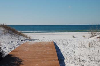
At the end of the walkway is the snow-like white sand of the beach.
|
|

There is a hard-packed bike and hike trail along the northern side of the park, from the pay station west to the fort. Opposite the Loop A campground we saw this little passage on a huge old beam through the grass and couldn't resist going to see where it led.
|
|
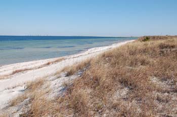
Here's what we found after a short walk over a grassy hillock - a beach on the bay-side looking across to Pensacola.
|
|

It's an enjoyable walk out to the beach to catch another Gulf sunset.
|
|
Amenities
200 sites with E(30/50A)/W
Dump station, Showers
Verizon Broadband Access (4G) service
Rates: $26 (50% discount with Golden Age Pass)
Coord: 30.32064 N, 87.27171 W
Activities/Nearby Attractions
Fishing/swimming
Fort Pickens and associated batteries
Pensacola Beach

|

